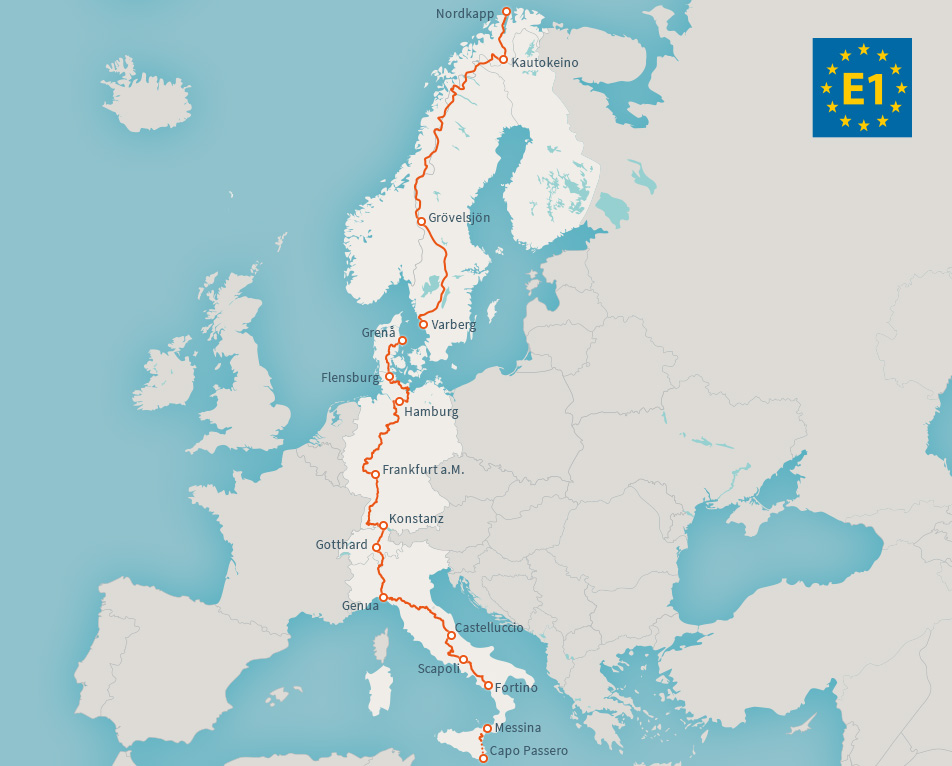
European long distance path E1
North Cape - Central Italy | 7 Countries | 8,000 km
The European long distance path E1 passes through seven european countries with a total length of about 8,000 km. It starts at North Cape in Norway and leads via Finland, Sweden, Denmark, Germany and Switzerland to Central Italy. The planned southern end will be the Capo Passero - a first section in Sicily was opened in 2016.
-
-
-
E1 on Wikipedia
General information about E1
https://en.wikipedia.org/wiki/E1_European_long_distance_path
European Ramblers Association
Information about the E-Paths
waymarkedtrails.org
Information including GPS downloads for wide parts ot the E1
E1 Hiking Tours
E1 Hiking Tours organizes hiking trips throughout Europe
-
The long walk
(german)
Hamburger Wanderjung
Wanderberichte vom E1 von Sälen (Schweden) bis Frankfurt am Main.
Lena & Thilo auf dem E1
Lena und Thilo sind im Mai 2016 auf dem E1 am Nordkap gestartet. Sie berichten auf ihrem Blog von ihrer Wanderung, die sie bis Sizilien nach Sizilien geführt hat.
E1 Traum
Thomas ist Anfang Juni 2017 am Nordkap mit dem Ziel Sizilien aufgebrochen und berichtet darüber in seinem Blog.
www.basel-nordkap.com
(german)
Netzwerk Weitwandern
A report from a hike on the E1 in Denmark (german)
Der Uhrmensch
(german)
http://deruhrmensch.wordpress.com/category/fernwanderweg/e1/
E1 X... mein Weg durch Deutschland
(german)
konstanze-1.de
(german)
Unterwegs...
Andrea und Ole wandern im Sommer 2017 auf dem E1 durch ganz Norwegen. Los geht es am 01. Juni in Grövelsjön mit dem Ziel Nordkap. In ihrem Blog berichten sie von Ihrer Vorbereitung und von unterwegs.
Michael wandert
Reports from Michaels hikes on the E1 in Denmark, Germany, Switzerland and from 2018 also Italy. (german)
With the mountain bike on the E1
Komoot collection with a mountain bike tour based on the E1. Currently for the section between Odenwald and Bellinzona (southern Switzerland).
https://www.komoot.de/collection/1132963/-mit-dem-mtb-auf-dem-e1


Character of the trail
E1 passes various types of landscapes, cultural and climate zones over a length of 8000km. Even in areas of high population it touches the most attractive areas, concerning landscape and culture while keeping a clear direction.
Already existing infrastructure of regional or long distance hiking pathways are utilized in some places.
Depending on country and region the difficulty, ease of finding accomodation and "wilderness factor" are different.
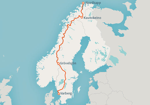
- The northermost stage in Scandinavia is very demanding. You need to carry nutrition for several days, as well as a tent. There are very few fixed accommodations.
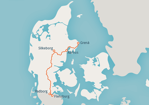
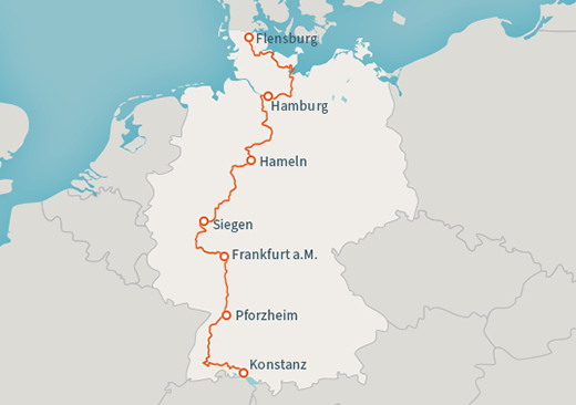
- The central European stage lead through areas with higher population densities, yet they sport beautiful landscapes as well as cultural points of interest. Accommodations are easily reachable so a tent is not necessary. These stages invite you to get familiar with your new long distance hiking hobby, but also to use them for regional hikes or hikes with children.
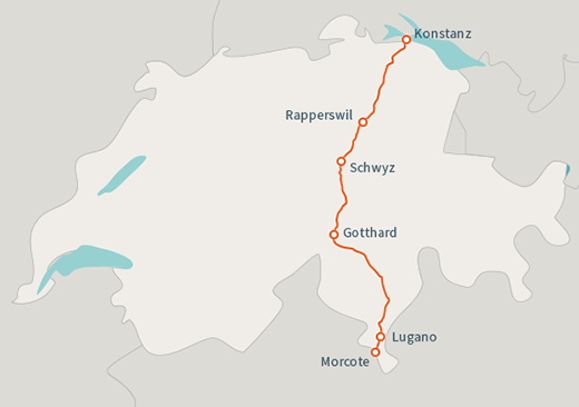
- In Switzerland the E1 is a relatively easy way to cross the Alps via the Gotthardpass.
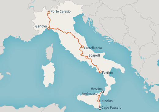
- The southern stage in Italy leads through the plains around the river Po and across the Appenin. The level of difficulty changes as well as the equipment which needs to be carried along, depending on where you are hiking.
The following users contributed to this text:
Translator(s) of this text: